Drone Applications in Ecology
- September 4, 2024
- 0 comment
Drone applications in ecology are revolutionizing the way we monitor wildlife, assess habitats, and detect environmental changes. These versatile tools have transformed ecological research, offering efficient, accurate, and cost-effective methods to study ecosystems. By providing real-time data and comprehensive aerial perspectives, drones are enhancing our ability to manage and conserve the environment like never before.
Drone Applications in Wildlife Monitoring and Conservation
Drones are invaluable tools for wildlife monitoring, allowing researchers to gather data in previously challenging or impossible ways.
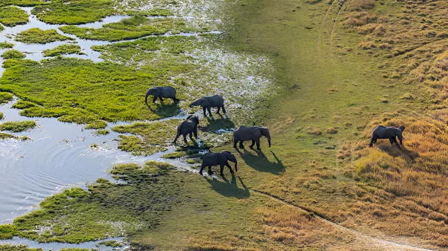
- Population Surveys: Drones equipped with high-resolution cameras can conduct aerial surveys to estimate animal populations. For instance, drones have been used to count marine mammals, such as seals and whales, by capturing images from the air without disturbing the animals.
- Behavioral Studies: By providing a non-intrusive vantage point, drones help observe animal behavior in their natural habitats. This method is less stressful for wildlife compared to traditional ground-based observations.
- Poaching Prevention: Drones equipped with thermal imaging can detect illegal activities, such as poaching, by identifying heat signatures of humans or vehicles in protected areas. They also facilitate rapid response by patrolling vast and remote areas more efficiently than ground teams.
Habitat Assessment and Management
Drones play a crucial role in habitat assessment and management by providing detailed aerial imagery and data:
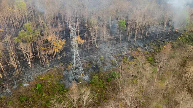
- Mapping and Surveying: Drones generate high-resolution maps and 3D models of landscapes, which are essential for habitat assessment and planning. These maps help ecologists understand terrain changes, vegetation cover, and habitat fragmentation.
- Monitoring Vegetation Health: Equipped with multispectral sensors, drones can monitor plant health by detecting variations in vegetation indices. This data is crucial for assessing the impact of environmental stressors, such as drought or disease, on plant communities.
- Restoration Projects: Drones assist in monitoring and evaluating the success of habitat restoration projects. They provide detailed images of reforested areas or wetlands, allowing for precise measurements of growth and recovery over time.
Environmental Change Detection
Understanding environmental changes is vital for effective conservation strategies. Drones offer several advantages in this area:
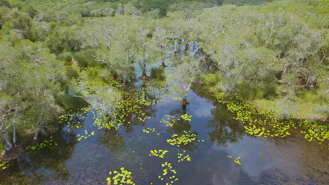
- Climate Change Impact: Drones can track changes in glaciers, ice caps, and coastal areas, providing valuable data on the effects of climate change. They offer insights into melting rates, sea-level rise, and erosion patterns.
- Pollution Monitoring: Drones can detect and monitor pollution sources, such as oil spills or chemical leaks, by capturing aerial images and using sensors to measure pollutants. This information is critical for assessing the extent of environmental damage and coordinating cleanup efforts.
- Disaster Response: In the aftermath of natural disasters like wildfires or floods, drones provide real-time aerial views of affected areas. This data helps in assessing damage, planning recovery efforts, and monitoring long-term impacts on ecosystems.
Drone Data Collection and Research
Drones enhance data collection and research capabilities with their advanced sensing technologies:
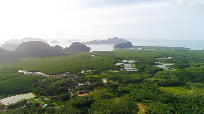
- Aerial Surveys: Drones equipped with LiDAR (Light Detection and Ranging) can capture detailed topographical data, which is essential for studying terrain features, forest structure, and habitat characteristics.
- Biodiversity Monitoring: By combining high-resolution imaging with other sensors, drones can identify and track species diversity within ecosystems. This data supports conservation strategies by revealing patterns of species distribution and habitat use.
- Longitudinal Studies: Drones facilitate long-term ecological studies by providing consistent and repeatable data collection methods. They allow researchers to monitor changes over time, such as forest regrowth or shifts in wildlife populations.
Ethical Considerations and Challenges
While drones offer numerous benefits, their use in ecology also raises ethical considerations and challenges:
- Disturbance to Wildlife: Although drones are generally less intrusive than manned aircraft, their presence can still disturb wildlife. It is crucial to follow guidelines and best practices to minimize impacts on animal behavior and habitat.
- Privacy Concerns: The use of drones for monitoring can raise privacy issues, particularly when operating near human communities. Ensuring transparency and respecting privacy boundaries are essential in addressing these concerns.
- Data Security: Managing and securing the data collected by drones is vital to protect sensitive information. Researchers must implement robust data management practices to safeguard against unauthorized access and misuse.
Conclusion
Drones have revolutionized the field of ecology by providing innovative solutions for monitoring, assessing, and managing natural environments. Their applications enhance our ability to understand and protect ecosystems, offering valuable insights into wildlife behavior, habitat conditions, and environmental changes. As technology continues to advance, drones are likely to play an increasingly significant role in ecological research and conservation efforts, helping to ensure a sustainable future for our planet’s diverse ecosystems.
FAQs
- What types of drones are used in ecological research?
Drones used in ecological research include quadcopters (multirotors) for stable flight and maneuverability, fixed-wing drones for longer flight durations and covering larger areas, and hybrid drones that combine features of both. Each type is chosen based on the specific needs of the research. - How do drones help in wildlife monitoring?
Drones assist in wildlife monitoring by providing aerial views that are less intrusive than traditional methods. They enable researchers to conduct population surveys, observe animal behavior, and detect poaching activities without disturbing wildlife. - What are the benefits of using drones for habitat assessment?
Drones provide high-resolution imagery and 3D models of habitats, allowing for detailed mapping and monitoring. They help in assessing vegetation health, tracking changes in land use, and evaluating the effectiveness of restoration projects. - How do drones contribute to detecting environmental changes?
Drones can capture real-time data on environmental changes such as climate impacts, pollution, and natural disasters. Their ability to cover large areas quickly and provide detailed imagery supports effective monitoring and response strategies. - Are drones capable of monitoring vegetation health?
Yes, drones equipped with multispectral sensors can monitor vegetation health by detecting variations in plant reflectance. This data helps identify areas affected by drought, disease, or other stressors. - What are the challenges of using drones in ecological research?
Challenges include potential disturbance to wildlife, privacy concerns when operating near human communities, data management and security issues, and the need for specialized training to operate drones effectively. - How do drones assist in poaching prevention?
Drones equipped with thermal imaging and high-resolution cameras can patrol protected areas to detect illegal activities, such as poaching. They can identify heat signatures of humans or vehicles, enabling quicker response by conservation teams. - Can drones be used for disaster response in ecological settings?
Yes, drones provide valuable real-time aerial views of areas affected by natural disasters like wildfires or floods. They help assess damage, plan recovery efforts, and monitor long-term impacts on ecosystems. - What is the role of LiDAR-equipped drones in ecology?
LiDAR-equipped drones capture detailed topographical data, which is essential for studying terrain features, forest structure, and habitat characteristics. This technology provides precise measurements of elevation and vegetation density. - How do researchers ensure that drone use does not disturb wildlife?
Researchers follow best practices and guidelines to minimize disturbance, such as flying at appropriate altitudes, using quiet drone models, and avoiding sensitive periods like breeding seasons. It’s essential to balance data collection with the welfare of wildlife.
Their ability to provide detailed aerial insights enhances our understanding of wildlife, habitats, and environmental changes. As technology evolves, drones will continue to play a crucial role in advancing ecological research and fostering more effective conservation strategies, ultimately helping to preserve our planet’s diverse ecosystems for future generations.

Kristine Moore
Forestry AuthorI'm Kristine Moore, a seasoned garden landscaping professional with over 30 years of experience. My extensive career has been dedicated to transforming outdoor spaces into stunning, sustainable landscapes. With a deep understanding of horticulture, design principles, and environmental stewardship, I have become a respected figure in the field, known for creating harmonious, visually appealing, and eco-friendly gardens. My commitment to excellence and continuous learning in landscaping trends and techniques has solidified my reputation as an expert in garden design and implementation.






Leave your comment