How Drones Are Used for Forestry Management
- August 23, 2024
- 0 comment
Drones, or unmanned aerial vehicles (UAVs), have changed how we manage forests. These flying machines can do many things that help forest workers and researchers keep an eye on trees and wildlife. With drones, they can easily gather information about the health of the forest, map out areas, and check for problems like pests or diseases.
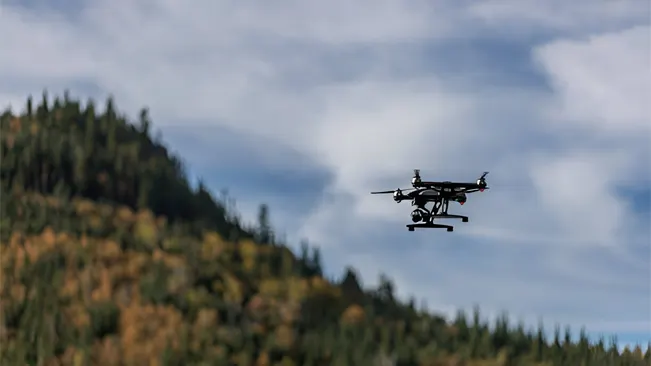
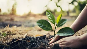
This technology is faster and often cheaper than older methods, making it easier to take care of our forests. Using drones in forestry allows for better planning and decision-making. For example, drones can quickly survey large areas, helping foresters decide where to plant new trees or when to harvest them.
They can also spot fires early, which is important for protecting both the forest and nearby communities. Overall, drones are becoming essential tools in forestry management, helping us to protect and manage our natural resources more effectively.
Aerial Surveying and Mapping
One of the main uses of drones in forestry is aerial surveying and mapping. Drones are equipped with high-resolution cameras and sensors that allow them to take clear pictures of forests from the sky. This ability to capture detailed images helps forest managers gather important information quickly and efficiently.
Drones can cover large areas in a short amount of time, making them much faster than traditional methods like walking through the forest or using helicopters. This speed is especially useful for tasks such as:
- Stand delineation and mapping: Identifying different sections of trees and their boundaries.
- Harvest planning: Providing data on the best times and methods for logging operations.
- Forest structure estimation and inventory: Offering information about tree types, heights, and density.
- Carbon inventory: Measuring how much carbon is stored in the trees to understand the forest’s impact on climate change.
- Damage assessments: Quickly evaluating the harm done to the forest after storms or pest outbreaks.
By using advanced techniques like photogrammetry and LiDAR (Light Detection and Ranging), drones can create accurate 3D models and maps of forest areas. Photogrammetry involves taking many overlapping photos to create detailed maps, while LiDAR uses laser pulses to measure distances and create detailed topographical maps. These technologies enable forest managers to visualize the forest in a way that was not possible before, allowing them to make informed decisions about how to manage and protect these vital ecosystems.
Forest Health Monitoring
Drones play a crucial role in monitoring the health of forests, which is essential for maintaining healthy ecosystems. They can detect early signs of problems such as diseases, pest infestations, and other threats that may harm trees. Equipped with multispectral and thermal cameras, drones can capture images that reveal important information about the forest’s condition.
Multispectral Imaging
- Multispectral cameras can see light wavelengths invisible to the human eye, allowing them to identify changes in vegetation health.
Thermal Imaging
- Thermal cameras can detect heat differences, helping to spot areas where trees may be stressed or unhealthy.
Early Detection and Prompt Action
- Early detection allows forest managers to take prompt action to reduce potential damage before it spreads widely.
- This proactive approach helps protect valuable ecosystems and ensures that forests remain healthy for wildlife and future generations.
Wildlife Monitoring
- Drones can detect the heat signatures of animals from the air, providing insights into animal behavior and populations without disturbing their habitats.
- This is especially useful for studying species that are difficult to observe from the ground.
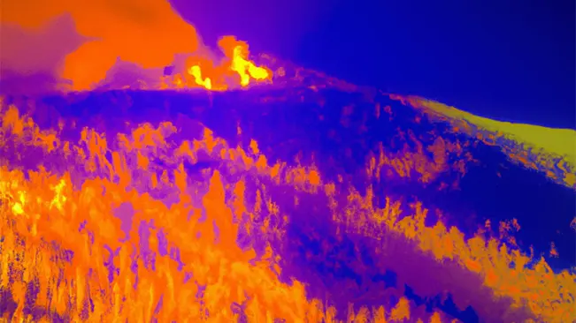
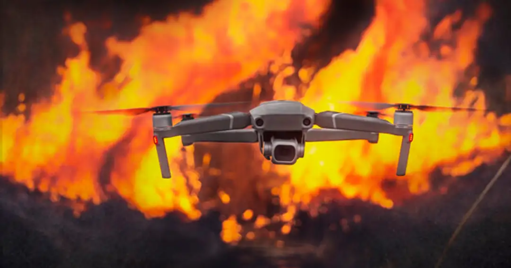
Fire Detection and Management
Drones equipped with thermal cameras are invaluable tools for detecting and managing forest fires. They can identify heat anomalies in forested areas, which helps in spotting fires in their early stages. This capability allows for rapid response times, minimizing potential damage to the forest and surrounding areas.
Drones can cover large areas quickly, providing real-time information to firefighting teams on the ground. This information is crucial for effective fire management strategies, enabling teams to allocate resources efficiently and respond to fires before they spread. Moreover, drones can be used for post-fire mapping, which involves assessing the extent of damage after a fire has occurred.
This mapping helps in understanding the impact of the fire on the forest and can guide recovery efforts. Drones can monitor the recovery of affected areas over time, providing data that helps forest managers evaluate the effectiveness of reforestation and restoration efforts.
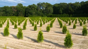
Precision Forestry
Drones enable precision forestry practices by providing detailed data on forest conditions and growth patterns. This information is essential for optimizing planting, thinning, and harvesting operations. For example, drones can help identify the best locations for planting new trees, ensuring that they are placed where they can thrive.
They can also assist in determining which trees should be thinned out to promote healthy growth among the remaining trees. In addition to monitoring growth, drones can be used for targeted spraying of pesticides or herbicides.
This targeted approach reduces the environmental impact and cost associated with traditional spraying methods, which often involve covering large areas indiscriminately. By applying treatments only where they are needed, drones help promote a healthier forest ecosystem.
Environmental Monitoring and Conservation
Drones play a significant role in environmental monitoring and conservation efforts in forested areas. They can monitor changes in temperature, humidity, and light levels, which are critical for understanding the health of the forest. Drones can also track the movements of animals and insects through their habitats, providing valuable data for conservationists.
By deploying sensor-containing darts or allowing drones to perch on tree branches, researchers can create networks of sensors that collect valuable data on forest ecosystems. This information is crucial for understanding the impact of climate change and human activities on natural environments. For instance, drones can help identify areas that are experiencing deforestation or habitat loss, enabling conservationists to take action to protect these vital areas.
Challenges and Future Developments
While drones offer numerous benefits for forestry management, there are still some challenges to overcome, such as legal barriers, ethical constraints, and technological limitations. As drone technology continues to evolve, researchers are working on improving their autonomy, energy efficiency, and performance in dense forest environments.
In the future, we can expect to see more advanced drone platforms equipped with a wider range of sensors and artificial intelligence capabilities. These developments will further enhance the efficiency and effectiveness of forestry management, helping us to better understand and protect our precious forest ecosystems.
Key benefits of using drones in forestry management
| Increased Efficiency and Cost-Effectiveness | Drones can quickly cover large areas of forest, making them faster than traditional ground methods and more affordable than helicopter surveys. This efficiency allows for more frequent monitoring without significantly increasing costs. |
| Improved Data Quality | Equipped with high-resolution cameras and sensors, drones capture detailed aerial imagery and data on forest conditions. They can easily access challenging terrains, providing comprehensive coverage of remote areas. |
| Enhanced Forest Health Monitoring | Drones can detect early signs of disease, pests, and other threats to tree health. This early detection enables forest managers to take prompt action, helping to protect valuable ecosystems. |
| Precision Forestry and Fire Management | Drones provide critical data for optimizing planting, thinning, and harvesting operations. They can also identify heat anomalies to detect fires early, allowing for rapid response and damage assessment. |
| Environmental Monitoring | Drones track changes in temperature, humidity, and wildlife movements, aiding conservation efforts by identifying areas at risk of deforestation or habitat loss. |
Overall, drones offer a more efficient, effective, and data-driven approach to managing forests, enhancing our ability to protect and sustain these vital ecosystems.
Conclusion
Drones have become indispensable tools in forestry management, offering unprecedented capabilities for monitoring, mapping, and protecting our forests. Their ability to quickly gather detailed data from challenging terrains allows for more efficient and cost-effective management practices.
From detecting early signs of disease to monitoring wildlife and managing forest fires, drones provide forest managers with vital insights that were previously difficult or impossible to obtain. As drone technology continues to advance, it will further revolutionize forestry management, helping to ensure the health and sustainability of our forests for future generations.
Frequently Asked Questions
1. What are drones used for in forestry management?
Drones are used for various tasks in forestry management, including aerial surveying, mapping, forest health monitoring, wildlife tracking, and fire detection. They provide detailed data that helps in decision-making and efficient management of forests.
2. How do drones help in forest health monitoring?
Drones equipped with multispectral and thermal cameras can detect early signs of disease, pest infestations, and other threats to forest health, enabling prompt action to protect ecosystems.
3. What is precision forestry, and how do drones contribute to it?
Precision forestry involves using detailed data to optimize planting, thinning, and harvesting operations. Drones contribute by providing high-resolution imagery and data that guide these activities, ensuring efficient and sustainable forest management.
4. Can drones be used to detect forest fires?
Yes, drones equipped with thermal cameras can detect heat anomalies, allowing for early detection of forest fires. This enables rapid response and helps minimize damage to the forest and surrounding areas.
5. How do drones assist in wildlife monitoring?
Drones can track the movements of animals and detect their heat signatures from the air. This allows researchers to study wildlife behavior and populations without disturbing their natural habitats.
6. What technologies do drones use for aerial surveying and mapping?
Drones use technologies like photogrammetry and LiDAR (Light Detection and Ranging) to create accurate 3D models and maps of forest areas. These technologies provide detailed information for forest management and planning.
7. Are drones cost-effective compared to traditional forestry management methods?
Yes, drones are generally more cost-effective and efficient than traditional methods like ground surveys or helicopter flyovers. They can cover large areas quickly, reducing the time and cost involved in monitoring forests.
8. What challenges exist in using drones for forestry management?
Challenges include legal barriers, ethical constraints, and technological limitations. However, ongoing advancements in drone technology are addressing these challenges, making drones more effective in dense forest environments.
9. How do drones contribute to environmental monitoring and conservation?
Drones monitor changes in temperature, humidity, and light levels, track wildlife movements, and identify areas at risk of deforestation. This data supports conservation efforts and helps protect vulnerable ecosystems.
10. What is the future of drones in forestry management?
The future of drones in forestry management includes advancements in autonomy, energy efficiency, and sensor technology. These developments will enhance their role in sustainable forest management and conservation efforts.
We hope this exploration of how drones are used in forestry management has provided you with valuable insights into the transformative impact of UAV technology in this field. Whether you’re involved in forest health monitoring, wildlife tracking, or precision forestry practices, understanding the capabilities and benefits of drones can help you make informed decisions to enhance your operations.
If you have any experiences or tips related to using drones for forestry management, please share them in the comments below. Your input can help others in the forestry community achieve better results in their work. Also, don’t forget to share this article with fellow forestry professionals and conservationists to spread knowledge about the power of drones in managing and protecting our forests. Stay innovative and effective in all your forestry endeavors!

James Wilson
Forestry AuthorJames Wilson has over 15 years of experience in forestry economics, specializing in sustainable practices, investment opportunities, and financial management. He has contributed to notable publications like "Forestry Today" and "EcoFinance Journal" and is known for providing practical and insightful advice. With a degree in Environmental Economics, James stays updated through continuous learning and active participation in industry discussions. Outside work, he enjoys hiking and nature photography, bringing a well-rounded perspective to his professional role.


Leave your comment