How Drones Are Safeguarding Nature and Safety in Forestry
- September 4, 2024
- 0 comment
In recent years, drones have revolutionized the field of forestry, offering a powerful tool for safeguarding both the natural world and human communities. By providing real-time data and advanced monitoring capabilities, drones enhance our ability to protect forests, detect threats, and manage resources more efficiently. This technology not only improves conservation efforts but also ensures a safer and more effective approach to managing the delicate balance between nature and human activity.
The Rise of Drone Technology in Forestry
Drone technology, initially developed for military and surveillance purposes, has seen remarkable evolution since its inception. The early drones, or Unmanned Aerial Vehicles (UAVs), were large, expensive, and primarily used for reconnaissance missions. In the late 20th century, technological advancements began to make drones more accessible and versatile.
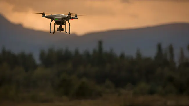
In the 2000s, miniaturization and improvements in battery life and GPS technology significantly reduced the size and cost of drones. This made them suitable for commercial and recreational use. By the 2010s, consumer-grade drones with high-resolution cameras became available, leading to their adoption in various fields, including forestry. These drones allowed for aerial imaging and mapping, providing new tools for forest management and conservation.
Why Use Drones in Forestry?
Using drones in forestry offers numerous advantages that significantly enhance both the efficiency and effectiveness of forest management. Drones provide high-resolution aerial imagery and real-time data, which are crucial for monitoring forest health, assessing biodiversity, and managing resources. By capturing detailed images and data from above, drones help detect changes in vegetation, identify areas affected by pests or diseases, and monitor the progress of reforestation projects. This capability allows forest managers to make informed decisions quickly, optimizing conservation efforts and ensuring sustainable management practices.
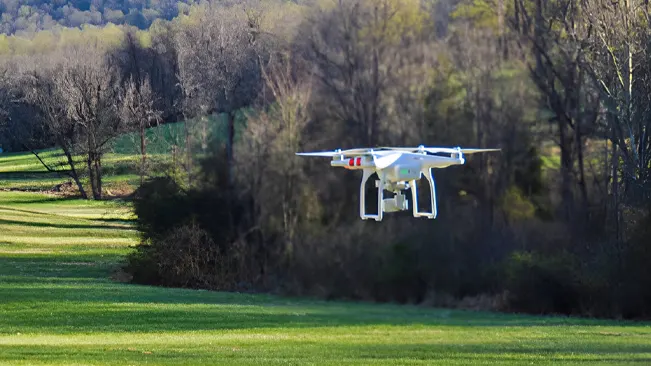
Additionally, drones improve safety and operational efficiency by reducing the need for on-ground inspections, which can be time-consuming and hazardous. With autonomous flight capabilities and advanced sensors, drones can cover large areas with minimal human intervention, reducing the risk to field workers and lowering operational costs. They are particularly valuable in remote or difficult-to-access areas, where traditional methods might be challenging or impractical. By integrating drones into forestry practices, organizations can enhance their ability to protect and manage forest ecosystems while ensuring safer and more cost-effective operations.
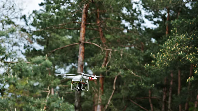
Benefits of Drones in Forest Protection
Enhanced Monitoring and Surveillance
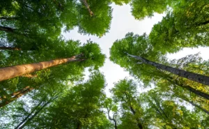
Drones equipped with high-resolution cameras and advanced imaging technology offer unparalleled clarity and detail in aerial imagery. This allows for precise monitoring of forest health and the identification of subtle changes over time. With their ability to capture detailed images and videos from various angles, drones facilitate early detection of problems such as pest infestations, diseases, and environmental stress. For instance, drones can identify signs of bark beetle infestations or fungal infections before they become widespread.
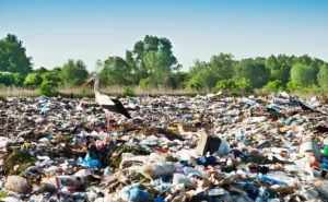
Additionally, drones can monitor and document illegal activities, such as poaching or unauthorized logging, providing crucial evidence for enforcement agencies. By conducting regular and comprehensive surveys across large forest areas, drones help forest managers quickly address and mitigate potential threats, maintaining the health and integrity of forest ecosystems.
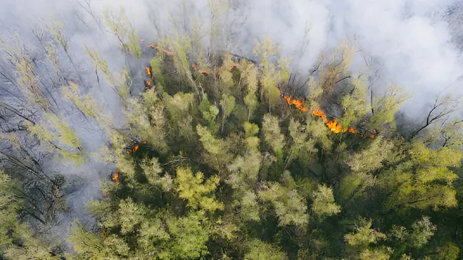
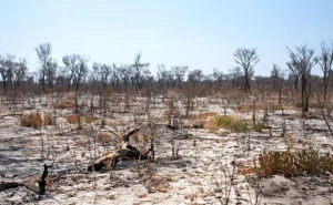
Efficient Fire Management
Drones equipped with thermal sensors and high-definition cameras provide a significant advantage in wildfire management. They can detect heat signatures from active fires, even under dense smoke or at night, offering a clearer picture of fire locations and intensity. This real-time thermal imaging enables firefighting teams to assess fire spread and hotspots with greater accuracy.
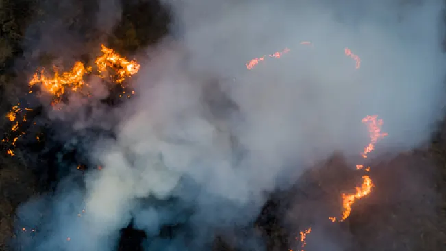
Drones can relay live data to command centers, allowing for dynamic adjustments to firefighting strategies and resource allocation. This capability enhances the coordination of firefighting efforts, ensuring that personnel and equipment are deployed where they are most needed. By providing timely and detailed information, drones help contain fires more effectively, reducing the risk of widespread damage and preserving valuable forest habitats.
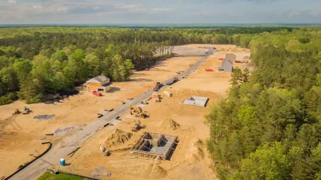
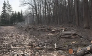
Accurate Mapping and Inventory
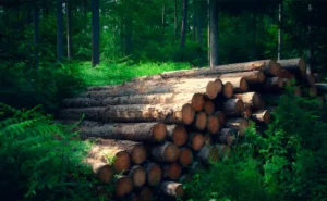
Drones excel at creating detailed and accurate maps of forest landscapes, including topographical features, vegetation types, and water sources. They use advanced technologies such as LiDAR (Light Detection and Ranging) and multispectral sensors to capture data that can be used to generate high-resolution maps. These maps are essential for assessing forest conditions, managing resources, and planning conservation projects.
For example, drones can create 3D models of forest canopies, helping to evaluate tree density and growth patterns. This data supports accurate inventory assessments, which are crucial for sustainable resource management and reforestation planning. By providing detailed and up-to-date information, drones assist in managing forest reserves and protected areas, ensuring that conservation efforts are based on accurate and comprehensive data.
Improved Accessibility
Drones offer a significant advantage in accessing remote or challenging forest areas that are difficult for ground crews to reach. In dense forests with thick canopies or rugged terrains, traditional surveying methods can be slow and hazardous. Drones can easily navigate these environments, capturing detailed data without the need for physical access.
This capability is particularly valuable in regions where traditional methods might be impractical or pose safety risks. For instance, drones can survey areas affected by landslides or floods, providing crucial information without endangering field workers. By reaching and monitoring these hard-to-access locations, drones enhance overall forest protection efforts, ensuring that even the most remote areas are adequately surveyed and managed.
Cost-Effective Operations
The use of drones in forest monitoring and protection can significantly reduce operational costs compared to traditional methods. Ground surveys often require extensive manpower, equipment, and time, which can be costly and labor-intensive. Drones, on the other hand, offer a more efficient alternative by covering large areas quickly and with fewer resources.
The initial investment in drone technology is offset by the reduced need for on-ground surveys and the lower cost of data collection. Additionally, drones minimize the environmental impact associated with traditional methods, such as the need for heavy machinery or extensive human presence in sensitive areas. By providing a cost-effective solution for ongoing surveillance and management, drones contribute to more sustainable and efficient forest protection efforts.
Increased Safety for Personnel
Drones contribute to the safety of field personnel by reducing the need for on-ground inspections in hazardous or difficult environments. Traditional forest monitoring often involves navigating challenging terrain or exposed conditions, which can be risky for field workers. Drones, by contrast, can perform surveys and collect data remotely, minimizing the need for physical presence in dangerous areas.
For instance, drones can monitor active wildfire zones or unstable terrain without putting personnel at risk. This increased safety is particularly important in remote or high-risk locations, where traditional methods may pose significant dangers. By using drones, forest management teams can conduct essential monitoring and protection tasks while ensuring the safety of their staff.
Enhancing Human Safety and Community Protection
Early Warning Systems for Natural Disasters
Drones play a crucial role in early warning systems for natural disasters such as wildfires and floods. Equipped with advanced sensors and imaging technology, drones can detect early signs of natural disasters before they escalate into major emergencies. For instance, drones with thermal imaging can identify hot spots or smoke patterns indicative of a wildfire, allowing authorities to issue warnings and mobilize resources before the fire spreads.
Similarly, drones can monitor weather conditions and river levels to predict potential flooding. By providing real-time data and aerial views, drones help in assessing the scale of the threat and issuing timely alerts to communities at risk. This proactive approach enables residents to take precautionary measures, evacuate if necessary, and minimize the impact of these disasters on human lives and property.
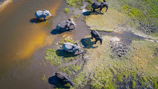
Monitoring and Mitigating Human-Wildlife Conflicts
Drones are increasingly used to monitor and manage human-wildlife conflicts, which are common in areas where human activities encroach on natural habitats. By providing an aerial perspective, drones can track the movements and behavior of wildlife, helping to identify patterns that might lead to conflicts. For example, drones can monitor wildlife migration routes and detect when animals are venturing too close to human settlements or agricultural areas.
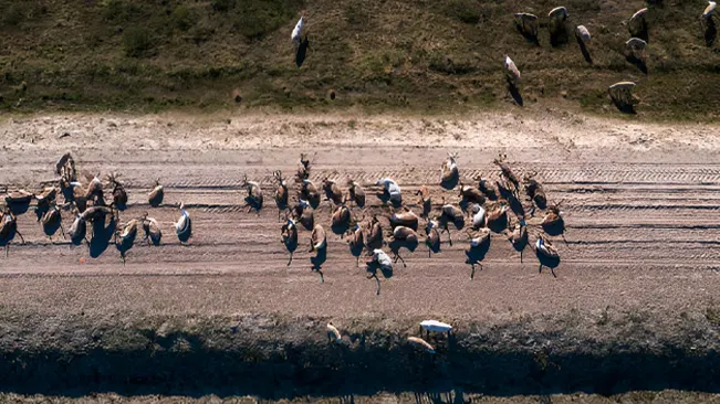
This information allows authorities and conservationists to implement measures to prevent conflicts, such as adjusting land use practices or setting up barriers. Additionally, drones can be used to assess the effectiveness of mitigation strategies and ensure that wildlife is not unduly disturbed. By improving our understanding of wildlife behavior and interactions with human activities, drones contribute to better management of conservation efforts and enhanced protection for both people and animals.
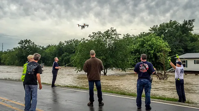
Providing Critical Information During Emergency Response Situations
In emergency response situations, drones provide invaluable support by delivering critical information quickly and efficiently. During disasters such as earthquakes, floods, or hurricanes, drones can survey affected areas, capturing detailed images and videos that help responders assess damage and plan their interventions. They can map out the extent of destruction, identify accessible routes, and locate survivors.
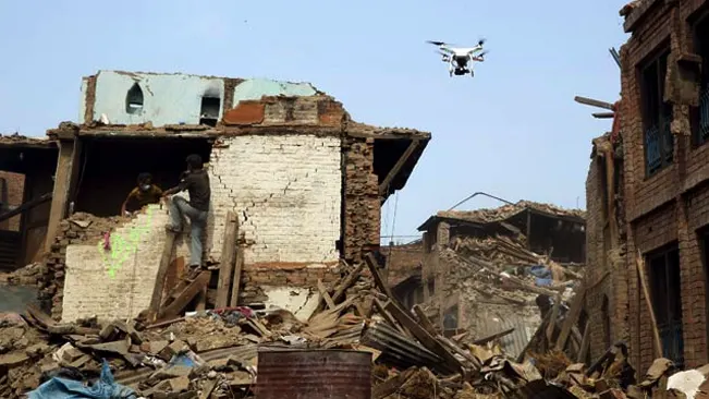
The ability to transmit real-time data allows emergency teams to make informed decisions about resource allocation, coordinate rescue operations, and prioritize areas for immediate assistance. Drones also facilitate communication in areas where traditional infrastructure may be damaged or non-functional, ensuring that emergency services can maintain connectivity and coordinate effectively. By providing timely and accurate information, drones enhance the overall efficiency of emergency response efforts and contribute to faster recovery and support for affected communities.
Conclusion
In conclusion, drones are revolutionizing forestry by providing essential tools for protecting natural ecosystems and enhancing human safety. Their real-time data and high-resolution imagery enable effective monitoring of forest health, early detection of fires, and efficient emergency responses. By improving resource management and reducing risks, drones are making forestry practices more efficient and sustainable, ensuring both environmental and community well-being.
FAQs
- What types of drones are used in forestry?
Drones used in forestry typically include quad copters, fixed-wing drones, and hybrid models. Quad copter drones are ideal for detailed aerial surveys and close-up monitoring, while fixed-wing drones are suited for covering large areas efficiently. Hybrid models combine the features of both, offering versatile applications. - How do drones help in wildfire management?
Drones assist in wildfire management by providing real-time thermal imaging to detect heat sources, mapping fire spread, and monitoring affected areas. This information helps firefighting teams respond quickly and effectively, reducing the risk of fires spreading and causing extensive damage. - Can drones be used for monitoring wildlife?
Yes, drones are used to monitor wildlife by tracking animal movements and behavior from the air. This helps in understanding wildlife patterns, managing human-wildlife conflicts, and ensuring the protection of endangered species. - How do drones improve forest health monitoring?
Drones enhance forest health monitoring by capturing high-resolution images and using sensors to detect signs of disease, pests, and environmental stress. This allows for early intervention and targeted management strategies to maintain forest health. - Are drones effective in remote or rugged terrains?
Yes, drones are particularly effective in remote or rugged terrains where traditional methods are challenging. They can access and survey difficult-to-reach areas, providing valuable data without the need for ground crews to navigate hazardous conditions. - How do drones contribute to reforestation efforts?
Drones support reforestation by creating detailed maps of deforested areas, monitoring planting progress, and assessing the success of reforestation projects. They can also be used to disperse seeds in hard-to-reach areas, accelerating the restoration of forests. - What are the safety benefits of using drones in forestry?
Drones enhance safety by reducing the need for on-ground inspections in hazardous environments, such as active fire zones or unstable terrains. This minimizes risks to field workers and ensures safer, more efficient operations. - How is drone data used in emergency response situations?
In emergency response, drones provide real-time aerial views and data of affected areas, helping responders assess damage, locate survivors, and plan their interventions. This timely information improves coordination and efficiency in managing crises. - Are there any legal or regulatory considerations for using drones in forestry?
Yes, the use of drones in forestry must comply with local regulations and aviation laws. This includes obtaining necessary permits, adhering to flight restrictions, and ensuring that operations are conducted safely and responsibly. - What is the cost of using drones for forestry applications?
The cost of using drones for forestry varies depending on the type of drone, its features, and the scope of the application. While the initial investment can be significant, the long-term benefits and cost savings from improved efficiency and reduced manpower often outweigh the costs.

Joel Cunningham
Forestry AuthorI'm Joel Cunningham, an expert in pruning and weed management with over a decade of experience. My skills are rooted in formal training and extensive practice, focusing on advanced pruning techniques and efficient weed control. I'm known for my quality work, precision, and deep understanding of plant health and soil dynamics. My contributions extend to educational initiatives where I share sustainable practices and advice, establishing myself as a reliable and authoritative figure in the gardening community.


Leave your comment