YellowScan Voyager Review 2024
- June 6, 2023
- 0 comment
In the dynamic landscape of LiDAR drone technology, standing at the apex of innovation and performance is a name that resonates with power and precision YellowScan. As the beating heart of this exciting realm, YellowScan has persistently pushed the boundaries to redefine what drone technology can achieve.
Today, we’re about to embark on an exhilarating journey to explore the depths of their flagship product—the YellowScan Voyager. As a fervent drone aficionado with years of experience in handling various LiDAR systems, I’ve spent what seems like an eternity, spiraling through the sky, pushing buttons, crunching data, and witnessing first-hand the exceptional capabilities of the Voyager.
My Experience with YellowScan Voyager
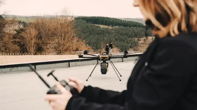
There’s an unmatchable thrill in the maiden flight of a drone, and my first encounter with the YellowScan Voyager was no different. But let’s be clear—it wasn’t just the rush of adrenaline that made this experience stand out. It was the seamless amalgamation of user-friendly technology with state-of-the-art LiDAR capabilities.
As someone who has had my fair share of piloting a myriad of drone systems, the flight control software of the Voyager was a revelation. The interface was intuitive, almost as if it understood my commands even before I issued them. From altitude adjustments to flight path alterations, every action was executed smoothly, reflecting the thoughtfulness behind the system’s design.
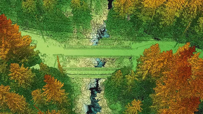
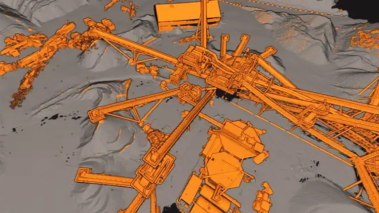
But the Voyager isn’t just about flying; it’s a data-collection powerhouse. The flight software doesn’t just respond to your flight controls it doubles as a monitoring system for data acquisition. Watching real-time data collection in action was like witnessing magic. From my controller, I could see the drone scanning the terrain, capturing thousands of data points every second, and forming a comprehensive, detailed, and vibrant point cloud that was a joy to behold.
The highlight of it all was the ability to visualize the live point cloud while operating the drone. Imagine watching a 3D map of the terrain unfold right in front of your eyes as you fly the drone. The connection between the terrain below and the digital representation on the screen created a captivating blend of reality and technology.
How the Voyager Measures Up
The YellowScan Voyager is an exceptional LiDAR (Light Detection and Ranging) system that excels in various quantitative performance metrics. Here, we will elaborate on the key capabilities that make it a standout choice:
- Range: The Voyager’s LiDAR sensor boasts an impressive range of 100 meters. This extensive range allows it to cover a significant area, making it particularly suitable for large-scale mapping projects. Whether it is surveying vast landscapes or conducting aerial inspections, the Voyager’s range ensures that it can capture data from a considerable distance.
- Accuracy: Accuracy is a crucial aspect of any LiDAR system, and the Voyager delivers remarkable precision. With a vertical accuracy of approximately 3 cm and a horizontal accuracy of around 1.5 cm, this system can capture highly detailed topographical data. Such exceptional accuracy enables users to obtain reliable and precise measurements of the terrain, objects, or structures being scanned.
- Data acquisition rate: The Voyager operates at an impressive data acquisition rate of 300,000 points per second. This rapid acquisition rate ensures that the system can capture an extensive number of data points within a short period. The ability to acquire data at such a high rate is crucial for comprehensive coverage and the generation of high-resolution maps. With an abundance of data points, the Voyager can capture intricate details of the environment, resulting in accurate and comprehensive representations.
Standout Features: What Sets the Voyager Apart
In a sky filled with drones, it takes a truly exceptional device to stand out and take the spotlight. The YellowScan Voyager does just that and more. It’s not just a drone—it’s a testament to the progress of LiDAR technology, a beacon illuminating the path for future innovations.
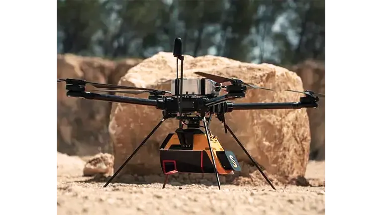
Superior Scanning Abilities – What truly elevates the Voyager above its counterparts is its extraordinary scanning prowess. Equipped with a state-of-the-art Velodyne Puck V2 LITE sensor, the Voyager captures highly accurate, intricate, and detailed topographical data. The sensor’s high data acquisition rate—collecting a staggering 300,000 points per second—enables it to paint a comprehensive and precise picture of the terrain below. Each flight results in a vibrant, dense point cloud that opens up new perspectives and insights about the landscape.

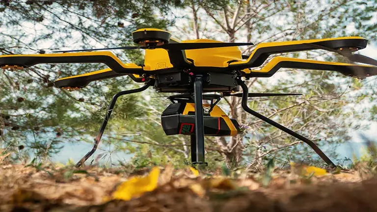
Versatility Unmatched – The YellowScan Voyager is akin to a chameleon—it adjusts to varying environments with ease. Thanks to its robust, all-weather design, it can perform reliably under a wide array of environmental conditions. Be it the dense, humid air of a rainforest or the crisp, dry atmosphere of a desert, the Voyager perseveres, capturing valuable data irrespective of the challenges posed by Mother Nature. Its versatility makes it a potent tool for a multitude of applications, ranging from forestry and environmental research to urban planning and infrastructure management.
User-Centric Operation – Simplicity in operation is the key to mastering complex technologies, and this is a principle that YellowScan has meticulously embedded in the Voyager. The flight control software is intuitive and user-friendly, which drastically reduces the learning curve for new users. Yet, at the same time, it offers advanced features and options for seasoned pilots to exploit.
Unrivaled Customer Support – Lastly, what truly sets Voyager apart is the exemplary customer service that YellowScan provides. The support team is always on their toes, ready to assist you with any technical glitches or operational queries. They are more than just a helpdesk; they are the co-pilots on your journey with Voyager, ensuring that each flight is smooth and successful. This commitment to enhancing the user experience adds another layer of reliability to the YellowScan brand.

The YellowScan Voyager isn’t just about impressive specs and innovative features—it’s about the seamless integration of technology, user experience, and unwavering support. It’s a comprehensive package that delivers not just on paper, but in the field, where it truly matters.
Comparable Drones & Ideal Use Cases
When considering other LiDAR drones, a close competitor is the RIEGL RiCOPTER. While the RiCOPTER also offers high-accuracy data acquisition, it’s worth noting that the YellowScan Voyager has a more compact design and an easier setup process.
Ideal use cases for the YellowScan Voyager range from forestry and environmental research to urban planning and infrastructure management. Its impressive data acquisition capabilities make it a reliable tool for professionals in these fields.
Pros & Cons
As is the case with any high-tech tool, the YellowScan Voyager has its strengths and weaknesses.
Pros:
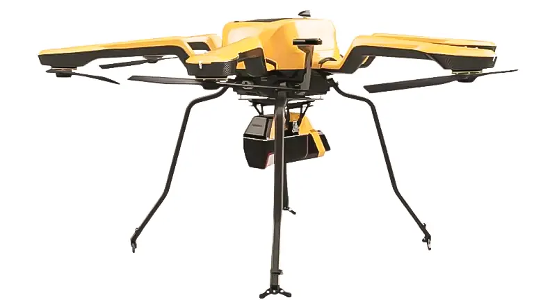
1. Compact and Lightweight Design – One of Voyager’s most commendable features is its compact and lightweight design. It weighs just 2.1 kg, including the LiDAR sensor, making it one of the lightest LiDAR drones on the market. This not only makes it easy to transport but also enhances its maneuverability during flight.
2. User-friendly Operation – YellowScan’s commitment to a user-centric approach is evident in Voyager. The intuitive flight control software is easy to master, making the drone accessible to both novices and experienced pilots alike. Plus, the real-time data visualization and monitoring further simplify the user experience, making data acquisition a breeze.
3. High-Accuracy Data Acquisition – The Voyager’s Velodyne Puck V2 LITE sensor is a marvel. It delivers high-accuracy data with a vertical precision of 3 cm and a horizontal precision of 1.5 cm. Furthermore, the sensor’s high data acquisition rate (300,000 points per second) ensures comprehensive and detailed coverage of the surveyed area.
4. Robust Customer Support – YellowScan’s stellar customer service rounds out Voyager’s pros. The responsive and knowledgeable support team is always ready to assist users, addressing technical issues or operational queries promptly and efficiently.
Cons:
1. Price Point – Quality comes at a cost, and the Voyager is no exception. Its price point is relatively high compared to some other LiDAR drones. However, it’s important to note that this is a professional-grade drone offering advanced features and superior performance.
2. Flight Time – Given the power requirements of the LiDAR sensor, Voyager’s flight time is somewhat shorter than some of its competitors. This could pose a limitation for prolonged surveying missions. However, the efficiency and speed of data acquisition often compensate for this, as the drone can cover large areas in a relatively short time.
The Evolution of the YellowScan Voyager
The YellowScan Voyager represents a significant evolution from its predecessors. One of the most notable improvements is the increased data acquisition rate, which has doubled from previous models. Additionally, the inclusion of a live point cloud feature greatly enhances the user’s ability to visualize the acquired data in real-time.
Impact of Design Choices
One of the key design choices that make the Voyager stand out is its compact, lightweight structure. This allows for easy transportation and deployment in remote areas, making the Voyager a highly practical choice for fieldwork.
The inclusion of intuitive flight control software is another design highlight, emphasizing YellowScan’s commitment to providing a user-friendly experience without compromising on performance.
The Final Verdict
The YellowScan Voyager delivers on its promise of high-quality, professional-grade aerial mapping.
As we reach the end of this exploration, it’s time to take a step back and consider the big picture. The YellowScan Voyager is more than just a LiDAR drone it’s a testament to the technological strides made in aerial mapping and data acquisition.
Yes, the Voyager comes with a higher price tag than some of its competitors. However, as is often the case, quality is proportional to cost. Every penny invested in the Voyager yields dividends in the form of unparalleled performance, exceptional versatility, and a user experience that is both intuitive and enjoyable.
The Voyager shines with its professional-grade capabilities. The high-accuracy data acquisition, coupled with an impressive range, allows the creation of detailed and comprehensive maps. This quality of data is invaluable across several fields.
If you’re an urban planner, Voyager’s high-resolution point clouds enable precise city modeling, making way for informed decision-making and effective planning. If you’re a forester, the extensive range of the Voyager makes it possible to study large tracts of forests with ease, providing insights into tree density, biomass, and health. For land surveyors, the Voyager’s data can be used to conduct detailed topographical surveys, evaluate land usage, or plan infrastructure.
But the Voyager isn’t solely about power-packed performance. It’s the little things that equally contribute to its charm—the compact and lightweight design, the user-friendly operation, and unparalleled customer support. These features elevate the YellowScan Voyager from a mere tool to an ally, an extension of your capabilities.
In summary, the YellowScan Voyager is an investment in quality, an asset to your professional toolkit. It’s a tool that does not just map terrains—it charts the course for your projects, driving them toward success. So, whether you’re an urban planner, a forester, a land surveyor, or someone who values the power of detailed geographical data, the YellowScan Voyager is ready to take your work to new heights.
Frequently Asked Questions about the YellowScan Voyager
1. What is the weight of the YellowScan Voyager?
The YellowScan Voyager, including the LiDAR sensor, weighs approximately 2.1 kg, making it one of the lightest LiDAR drones on the market.
2. What is the range of the YellowScan Voyager?
The LiDAR sensor of the YellowScan Voyager has a range of up to 100 meters. This wide range allows for extensive coverage during aerial mapping operations.
3. What is the data acquisition rate of the YellowScan Voyager?
The YellowScan Voyager is capable of acquiring data at an impressive rate of 300,000 points per second. This ensures comprehensive coverage and the creation of high-resolution maps.
4. What is the accuracy of the YellowScan Voyager?
The Voyager boasts impressive accuracy levels. The system’s vertical accuracy is about 3 cm, while the horizontal accuracy is approximately 1.5 cm.
5. Is the YellowScan Voyager suitable for beginners?
Yes, the Voyager is user-friendly and accessible to beginners. It is equipped with intuitive flight control software that new users can learn quickly. However, it’s important to note that, as with any drone, safe operation requires training and practice.
6. How does the YellowScan Voyager perform in various weather conditions?
Thanks to its robust, all-weather design, the YellowScan Voyager can operate reliably under various environmental conditions, from humid rainforests to dry deserts.
7. Is the cost of the YellowScan Voyager justified?
While the YellowScan Voyager does come at a higher price point compared to some other LiDAR drones, its advanced features, superior performance, and robust customer support make it a worthy investment for professional applications.
8. What are the potential applications of the YellowScan Voyager?
The YellowScan Voyager is versatile and can be used in a variety of fields. These include but are not limited to forestry and environmental research, urban planning, infrastructure management, agriculture, and land surveying.
9. Does YellowScan provide customer support for Voyager?
Absolutely! YellowScan offers robust customer support for Voyager. The support team is always ready to assist users with technical issues or operational queries.

David Murray
Forestry AuthorI'm David Murry, a forestry equipment specialist with a focus on chainsaw operation. With over 13 years of experience, I've honed my skills in operating and maintaining a wide range of machinery, from chainsaws to log splitters. My passion for the outdoors and commitment to sustainable forestry drive my work, which emphasizes safety, efficiency, and staying updated with industry advancements. Additionally, I'm dedicated to sharing my expertise and promoting environmental awareness within the forestry community.

Leave your comment