Explore the Top 15 Must-See Hiking Trails in Colorado for 2025: Your Ultimate Guide
- March 29, 2024
- 0 comment
Discover Colorado’s top 15 hiking trails for 2025. Perfect for all levels, explore stunning landscapes & adventures. Your ultimate hiking guide. Colorado, known for its breathtaking landscapes ranging from rugged mountains to sweeping plains, stands as a hiker’s paradise. The state’s natural beauty offers an array of trails that cater to all, from leisurely walkers to adventure-seeking trekkers. As we look towards 2025, the quest for the perfect hike becomes more exciting than ever.
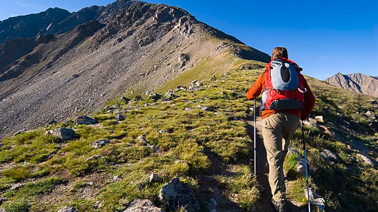
This guide meticulously compiles the top 15 must-see hiking trails in Colorado, chosen based on scenic beauty, uniqueness, accessibility, and avid hiker reviews. Our aim is not just to list trails but to equip you with a comprehensive overview to enhance your hiking experience.
List of Top 15 Must-See Hiking Trails in Colorado for 2025
- Maroon Bells Scenic Loop
- Conundrum Hot Springs
- The Hanging Lake Trail
- Sky Pond
- Emerald Lake Trail
- Mount Elbert Trail
- Black Canyon of the Gunnison Inner Canyon Trail
- Ice Lakes Trail
- Devil’s Backbone Nature Trail
- Four Pass Loop
- Roxborough State Park Trails
- Lost Man Loop
- Crater Lakes Trail in the James Peak Wilderness
- The Colorado Trail: Segment 1
- Garden of the Gods Loop
Why Hike in Colorado?
Colorado stands out as a premier hiking destination for several compelling reasons:
- Diverse Landscapes: Colorado’s unique geography offers a wide range of hiking experiences. From the majestic Rocky Mountains to the tranquil beauty of alpine lakes and the rugged landscapes of the high desert, hikers can find trails that match every interest and skill level.
- Four Season Adventure: Unlike many other regions, Colorado’s hiking trails offer distinct experiences across all four seasons. Spring blooms, summer alpine meadows, spectacular fall colors, and winter wonderlands mean there’s always something new to explore.
- Accessibility: With trails ranging from easy walks to challenging backcountry treks, Colorado accommodates hikers of all ages and abilities. Many trails are also conveniently located near urban areas, making it easy to start exploring nature.
- Conservation Efforts: Colorado places a strong emphasis on conservation and responsible recreation. Hikers have the opportunity to enjoy well-maintained trails while contributing to the preservation of natural beauty through respectful practices.
- Community and Culture: The hiking community in Colorado is vibrant and welcoming, offering a chance to connect with like-minded individuals. Additionally, exploring Colorado’s trails can lead to discovering the rich history and culture of the area, from ancient geological formations to historical sites.
In essence, hiking in Colorado is not just about physical activity; it’s about immersing yourself in an environment that invigorates the body, stimulates the mind, and soothes the soul. Whether you’re seeking solitude, adventure, or simply a connection with nature, Colorado’s trails provide the perfect backdrop for your journey.
Top 15 Must-See Hiking Trails in Colorado for 2025
1. Maroon Bells Scenic Loop
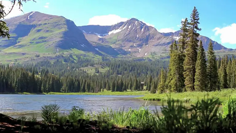
The Maroon Bells Scenic Loop is arguably one of the most photographed locations in Colorado, if not the entire United States. This relatively easy hike offers stunning views of the Maroon Bells, two iconic fourteeners that reflect beautifully on the surface of Maroon Lake. The trail takes hikers through aspen groves and alpine landscapes, offering vibrant wildflowers in spring and summer, and golden hues in the fall. It’s a must-see for any nature lover or photographer.
- Location: Near Aspen, in the Maroon Bells-Snowmass Wilderness
- Exact Size: 3.2 miles (5.15 km) round trip
- Difficulty: Easy
- Special Features: Iconic Maroon Bells view, Maroon Lake, wildflowers, wildlife sightings
- How to Get There: Access is via Maroon Creek Road from Aspen. During peak seasons, a shuttle bus from Aspen Highlands is required due to parking restrictions.
2. Conundrum Hot Springs
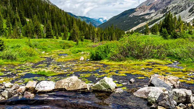
For those seeking a more challenging hike with a unique reward, the Conundrum Hot Springs trail offers just that. The trail winds through beautiful alpine landscapes, with the final destination being the natural hot springs themselves. These remote springs provide a perfect setting to relax and soak while enjoying the stunning mountainous backdrop. The hike is strenuous, but the reward is well worth the effort, providing a serene wilderness experience.
- Location: Near Aspen
- Exact Size: 17 miles (27.36 km) round trip
- Difficulty: Hard
- Special Features: Natural hot springs, alpine views, wildlife
- How to Get There: The trailhead is located on Conundrum Creek Road, accessible from Castle Creek Road, south of Aspen. Parking is limited, and overnight permits are required for camping.
3. The Hanging Lake Trail
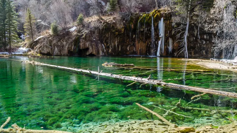
The Hanging Lake Trail is a short but steep hike leading to one of Colorado’s most beautiful natural formations. The lake is suspended on the edge of Glenwood Canyon’s cliffs, with waterfalls feeding into its crystal-clear, turquoise waters. The trail is challenging due to its steep incline and rocky path, but the ethereal beauty of Hanging Lake makes it a worthwhile endeavor for those who take on its ascent.
- Location: Glenwood Canyon
- Exact Size: 2.4 miles (3.86 km) round trip
- Difficulty: Moderate
- Special Features: Hanging Lake, waterfalls, unique geological formations
- How to Get There: The trailhead is located off I-70 in Glenwood Canyon, east of Glenwood Springs. Due to the trail’s popularity, reservations and a shuttle system are in place during peak months.
4. Sky Pond
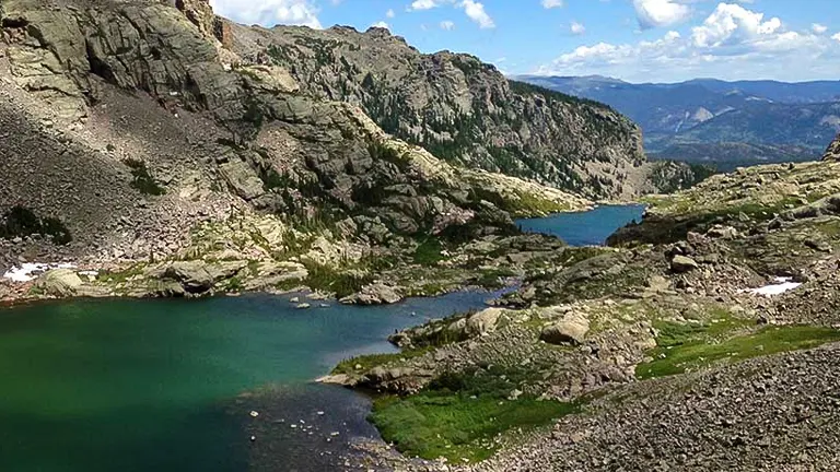
Sky Pond is a spectacular alpine lake located within the Rocky Mountain National Park, offering hikers breathtaking views of the surrounding peaks and waterfalls along the way. The hike to Sky Pond passes several landmarks, including Alberta Falls and The Loch, before reaching the Timberline Falls scramble, which leads to the lake. It’s a challenging hike but provides one of the most rewarding alpine experiences in Colorado.
- Location: Rocky Mountain National Park
- Exact Size: 9 miles (14.48 km) round trip
- Difficulty: Hard
- Special Features: Alberta Falls, The Loch, Timberline Falls, alpine scenery
- How to Get There: The trail starts at the Glacier Gorge Trailhead in Rocky Mountain National Park. Park entrance fees and timed-entry reservations may be required.
5. Emerald Lake Trail
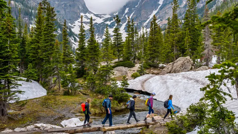
Emerald Lake Trail in Rocky Mountain National Park is a popular hike that offers easy access to some of the park’s most scenic landscapes. The trail passes by Nymph Lake and Dream Lake before ending at Emerald Lake, which sits at the base of Hallett Peak. This hike provides stunning views throughout and is accessible to hikers of all skill levels, making it a perfect family adventure.
- Location: Rocky Mountain National Park
- Exact Size: 3.6 miles (5.79 km) round trip
- Difficulty: Easy to Moderate
- Special Features: Nymph Lake, Dream Lake, panoramic mountain views
- How to Get There: The hike begins at the Bear Lake Trailhead in Rocky Mountain National Park. Like Sky Pond, park entrance fees and timed-entry reservations may apply.
6. Mount Elbert Trail
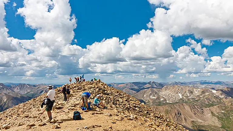
Mount Elbert, Colorado’s highest peak, provides a moderately challenging yet rewarding trail to the summit. As you ascend, the path offers expansive views of the surrounding Rockies. The sense of achievement upon reaching the top is unparalleled, standing at the summit of the Rockies. The trail is well-marked and offers various routes to accommodate different skill levels, making it accessible to a broader range of hikers seeking the thrill of conquering Colorado’s highest point.
- Location: Near Leadville, in the San Isabel National Forest
- Exact Size: 9 miles (14.5 km) round trip via the Northeast Ridge
- Difficulty: Moderate to Hard
- Special Features: Highest peak in Colorado, panoramic views, alpine flora
- How to Get There: The trailhead is located off Halfmoon Road (County Road 11) near Leadville. Parking is available at the North Mount Elbert Trailhead.
7. Black Canyon of the Gunnison Inner Canyon Trail
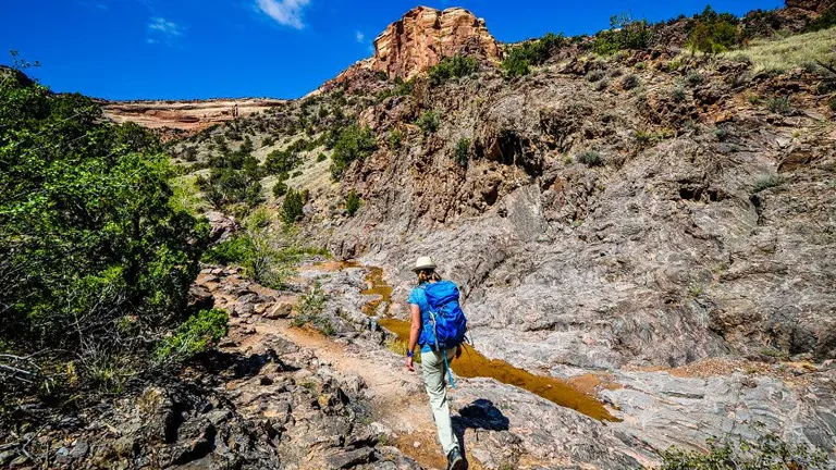
For those seeking a unique and strenuous adventure, the Inner Canyon trails of the Black Canyon of the Gunnison offer a rare glimpse into one of Colorado’s most dramatic landscapes. This series of unmaintained routes leads adventurous hikers down steep gullies to the Gunnison River. The routes require careful navigation and a wilderness permit, but the reward is the unmatched beauty and solitude of the Black Canyon’s depths.
- Location: Black Canyon of the Gunnison National Park
- Exact Size: Varies by route, up to 2 miles (3.2 km) one way
- Difficulty: Very Hard
- Special Features: Dramatic canyon views, Gunnison River, solitude
- How to Get There: Access is from various points along the South Rim and North Rim of the park. Permits are required and can be obtained at the visitor center.
8. Ice Lakes Trail
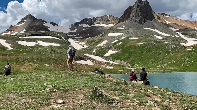
The Ice Lakes Trail is a breathtaking journey through some of the San Juan Mountains’ most stunning landscapes. This hike takes you past lower Ice Lake before climbing to the vibrant blue upper Ice Lake, one of Colorado’s most beautiful spots. The trail is challenging, with steep sections and high elevation, but the views of the surrounding peaks and the brilliant colors of the lakes are unforgettable.
- Location: Near Silverton, in the San Juan National Forest
- Exact Size: 8.4 miles (13.5 km) round trip
- Difficulty: Hard
- Special Features: Turquoise lakes, wildflowers, alpine vistas
- How to Get There: The trailhead is located off County Road 7 (Forest Road 585), accessible from Silverton. High-clearance vehicles are recommended.
9. Devil’s Backbone Nature Trail
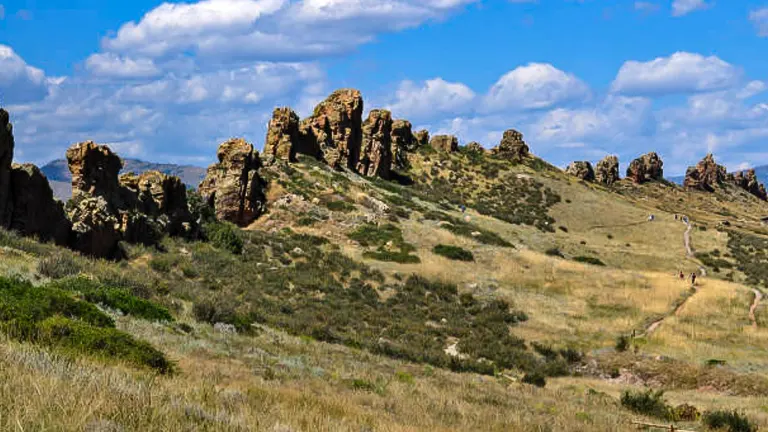
The Devil’s Backbone Nature Trail is a unique and relatively easy hike near Loveland, offering fascinating geological formations and picturesque views of the Front Range. The trail winds its way along a narrow ridge, known as the Devil’s Backbone, providing hikers with a close-up look at the area’s distinctive rock layers and formations. It’s a great hike for families and those looking for a leisurely outdoor experience with plenty of photo opportunities.
- Location: Near Loveland
- Exact Size: 4.3 miles (6.9 km) round trip
- Difficulty: Easy to Moderate
- Special Features: Unique rock formations, views of the Front Range, wildlife
- How to Get There: The trailhead is located off of Highway 34, just west of Loveland. Parking and trail access are free.
10. Four Pass Loop
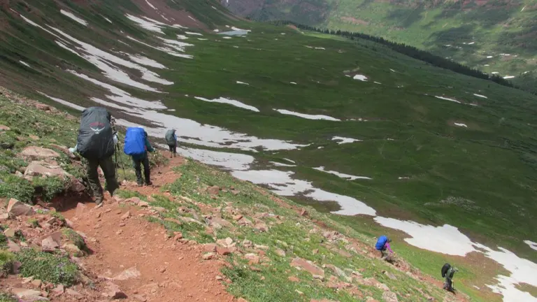
The Four Pass Loop in the Maroon Bells-Snowmass Wilderness is a challenging and rewarding multi-day hike that takes adventurers over four mountain passes, each over 12,000 feet. This loop offers some of the most spectacular alpine scenery in the Rockies, with endless fields of wildflowers, crystal-clear streams, and panoramic views of the surrounding peaks. The trail is demanding but provides an unforgettable experience for those prepared for a multi-day trek in high elevation terrain.
- Location: Near Aspen, in the Maroon Bells-Snowmass Wilderness
- Exact Size: 26 miles (41.8 km) loop
- Difficulty: Hard
- Special Features: Four mountain passes, alpine lakes, wildflowers, wildlife
- How to Get There: The loop typically starts and ends at the Maroon Lake Scenic Trailhead, accessed via Maroon Creek Road from Aspen. Parking is limited, and shuttle bus service is often required during peak seasons.
11. Roxborough State Park Trails
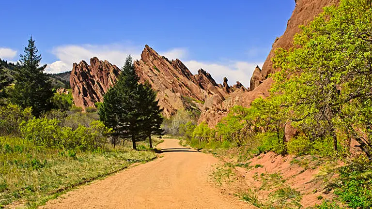
Roxborough State Park, a hidden gem just south of Denver, is a sanctuary of peace and natural beauty. The park offers a variety of trails that weave through striking red rock formations, lush forests, and open meadows. The Fountain Valley Trail, in particular, provides an easy and family-friendly hike with breathtaking views of the rock formations that make Roxborough a unique geological wonder.
- Location: Near Littleton, in Roxborough State Park
- Exact Size: Fountain Valley Trail – 2.3 miles (3.7 km) loop
- Difficulty: Easy
- Special Features: Dramatic red rock formations, wildlife viewing opportunities, seasonal wildflowers
- How to Get There: The park is located off Roxborough Drive, with the trailhead easily accessible from the visitor center. Note that the park has an entrance fee.
12. Lost Man Loop
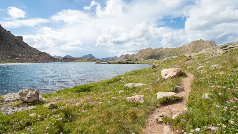
The Lost Man Loop is a high-alpine adventure that takes hikers through some of the most scenic parts of the Rocky Mountains near Independence Pass. The trail offers stunning views of alpine lakes, meadows filled with wildflowers, and the chance to spot local wildlife. The loop is best tackled in late summer when the snow has melted, revealing the full beauty of the high country.
- Location: Near Aspen, along Highway 82
- Exact Size: 8.8 miles (14.2 km) loop
- Difficulty: Moderate
- Special Features: Alpine lakes, wildflowers, panoramic mountain views
- How to Get There: The trailhead is located on Highway 82 near the Lost Man Campground, approximately 19 miles east of Aspen. Parking is available at the trailhead.
13. Crater Lakes Trail in the James Peak Wilderness
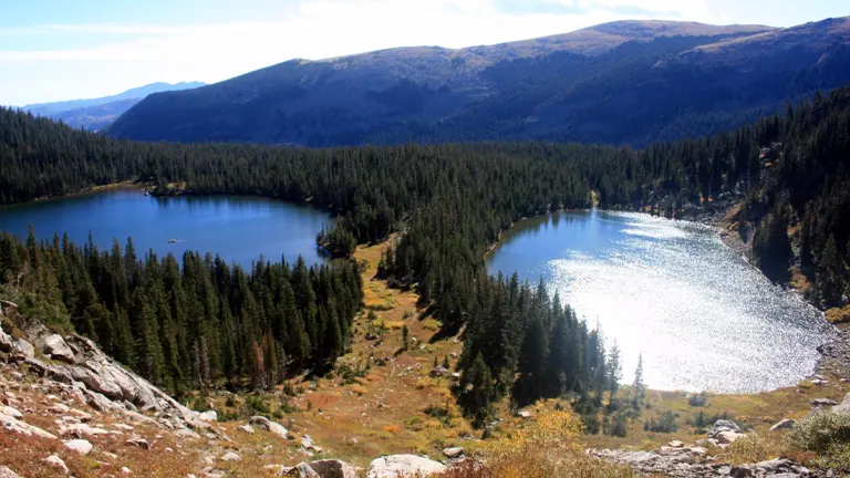
The Crater Lakes Trail invites hikers into the heart of the James Peak Wilderness, leading to a series of stunning alpine lakes nestled in a glacial basin. The hike starts from the Moffat Tunnel East Portal, gradually ascending through dense forests before opening up to the breathtaking views of the Crater Lakes. This trail offers a perfect mix of challenging terrain and rewarding landscapes, ideal for those looking to immerse themselves in Colorado’s alpine beauty.
- Location: Near Rollinsville
- Exact Size: 6 miles (9.7 km) round trip
- Difficulty: Moderate
- Special Features: Alpine lakes, dense forests, potential for wildlife sightings
- How to Get There: The trailhead is located at the East Portal of the Moffat Tunnel, accessible via Tolland Road off Highway 119. Parking is available at the trailhead.
14. The Colorado Trail: Segment 1
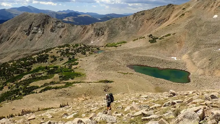
The Colorado Trail spans over 500 miles from Denver to Durango, offering one of the most comprehensive hiking experiences in the state. Segment 1 of the trail, from Waterton Canyon to South Platte River, serves as a fantastic introduction to the diverse landscapes the trail encompasses. This segment features gentle inclines, forested paths, and open meadows, making it accessible to hikers of all skill levels seeking a taste of the Colorado Trail’s extensive journey.
- Location: Begins in Waterton Canyon, near Littleton
- Exact Size: 16.8 miles (27 km) one way
- Difficulty: Moderate
- Special Features: Wildlife sightings, including bighorn sheep; diverse landscapes from canyons to forests
- How to Get There: The trailhead is located at the end of Waterton Road, with ample parking available. Shuttle arrangements or a two-car setup may be needed for point-to-point hiking.
15. Garden of the Gods Loop
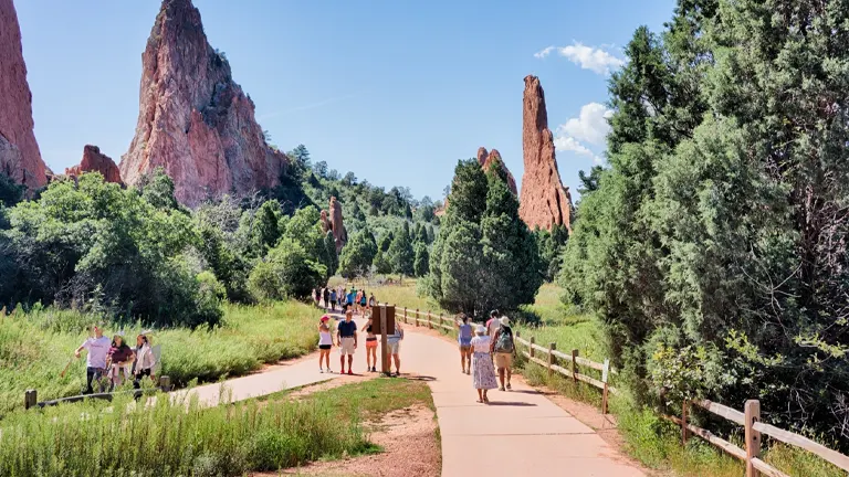
Garden of the Gods in Colorado Springs offers a network of trails that allow visitors to explore its stunning geological formations up close. The Perkins Central Garden Trail is an easy, paved loop that provides spectacular views of the park’s towering sandstone rock formations, including the famous Kissing Camels and Balanced Rock. This accessible trail is perfect for families and those seeking a leisurely walk amidst some of Colorado’s most iconic landscapes.
- Location: Colorado Springs, in Garden of the Gods Park
- Exact Size: 1.5 miles (2.4 km) loop
- Difficulty: Easy
- Special Features: Sandstone formations, accessible paths, panoramic views
- How to Get There: The park is located off North 30th Street in Colorado Springs. Parking and trail access are free, with the trailhead starting at the main parking lot.
Enhancing Your Hiking Experience
Connecting with Nature
Hiking in Colorado is more than a physical activity; it’s an opportunity to connect deeply with nature. To enhance this connection, consider these practices:
- Leave No Trace: Preserve the natural beauty of Colorado by following Leave No Trace principles. This means packing out all trash, staying on designated trails, and respecting wildlife.
- Mindfulness: Take moments to stop and immerse yourself in the environment. Listen to the sounds of nature, breathe in the fresh air, and observe the details around you.
- Journaling: Bring a journal to sketch or write about your experiences. This can deepen your connection to the places you visit and serve as a cherished memory of your hikes.
Wildlife Watching Tips
Colorado’s trails are home to a rich variety of wildlife. To safely observe and enjoy wildlife:
- Keep a Safe Distance: Always maintain a safe distance from animals to avoid disturbing them. Use binoculars for a closer look.
- Quiet Observation: Move quietly and patiently. Often, wildlife will appear when you are silent and still.
- Be Informed: Familiarize yourself with the types of wildlife you might encounter and understand their behaviors. This knowledge can enhance your experience and ensure your safety.
Photography on the Trail
Capturing the beauty of Colorado’s landscapes can add a rewarding element to your hikes. Here are some tips for trail photography:
- Golden Hours: The best light for photography is often during the golden hours, shortly after sunrise or before sunset. Plan your hikes to capture these moments.
- Composition: Look for leading lines, interesting rock formations, or vibrant wildflowers to create compelling compositions.
- Respect Nature: While capturing the perfect shot, ensure you’re not damaging the environment. Stay on trails and avoid trampling vegetation.
Beyond the Trail
Local Communities
Exploring local communities near the hiking trails can enrich your Colorado adventure:
- Support Local: Visit local eateries, shops, and markets. Your support helps sustain the communities that serve as gateways to Colorado’s natural wonders.
- Cultural Events: Participate in local cultural events or festivals. This can offer insights into the area’s heritage and traditions.
Conservation Efforts
As hikers, we have a responsibility to contribute to the preservation of the trails and natural areas we enjoy:
- Volunteer: Many organizations offer opportunities to volunteer for trail maintenance and conservation projects. This is a great way to give back and ensure these trails remain accessible for future generations.
- Donate: Consider donating to local and national parks, as well as conservation organizations working in Colorado. Your contributions can make a significant difference in ongoing preservation efforts.
Preparing for Your Hike
Before setting foot on the trail, preparation is key. Colorado’s diverse terrains mean that hikers need to be well-equipped and mindful of safety at all times.
Safety First
The wilderness of Colorado, while beautiful, can pose various challenges. Sudden weather changes, wildlife encounters, and trail difficulties are common. Here are essential safety tips:
- Weather Awareness: Colorado’s weather can change abruptly. Check forecasts before departing and prepare for all conditions.
- Wildlife Wisdom: Encounters with wildlife, while often exhilarating, require caution. Keep a safe distance, especially from larger animals like bears and moose.
- Trail Familiarity: Know your trail. Understanding the trail’s length, elevation changes, and difficulty can prevent unexpected challenges.
What to Bring
A successful hike begins with the right gear. Here’s a quick checklist:
- Navigation Tools: A map and compass or a GPS device are essential for trail guidance.
- Water and Snacks: Stay hydrated and energized. Pack more water than you think you’ll need, alongside high-energy snacks.
- Appropriate Clothing: Dress in layers to easily adjust to changing temperatures. Don’t forget a hat and sunscreen.
Best Times to Hike
Timing can significantly impact your hiking experience. While Colorado’s hiking season typically spans from late spring to early fall, some trails become magical winter wonderlands, accessible with the right gear like snowshoes or skis.
- Spring: Expect melting snow and wildflowers. Trails at lower elevations are best during this time.
- Summer: Ideal for high-altitude treks. Be wary of afternoon thunderstorms, particularly in the mountains.
- Fall: Offers cooler temperatures and stunning autumn foliage. A perfect time for hiking before the snow sets in.
- Winter: Though many trails are snow-covered, lower elevation hikes can still be accessible, offering serene landscapes.
Conclusion
Colorado’s diverse landscapes offer an unparalleled hiking experience, from serene lakes nestled in alpine basins to majestic peaks and vibrant wildflower meadows. By following the guidelines and tips provided, you can ensure a safe, enjoyable, and meaningful adventure. Embrace the spirit of exploration and let the trails of Colorado inspire you to connect with nature, challenge yourself, and discover the beauty of the outdoors. Remember, the journey is as significant as the destination, and every step taken on these trails contributes to your story as an explorer of the natural world.
FAQs
- Can I complete any of these trails if I’ve never hiked in high altitude before?
Yes, trails like the Maroon Bells Scenic Loop and the Garden of the Gods Loop are excellent starting points for those new to high-altitude hiking. It’s vital to acclimate yourself to the elevation, stay hydrated, and take it slowly to prevent altitude sickness. - What’s the best way to experience wildlife safely while hiking these trails?
To safely observe wildlife, keep a respectful distance, avoid feeding animals, and use binoculars for closer views. Always hike with awareness of your surroundings and follow park guidelines on wildlife encounters. - Are there any trails that offer unique geological features?
Yes, the Black Canyon of the Gunnison Inner Canyon Trail and the Roxborough State Park Trails offer exceptional geological formations. These trails allow hikers to appreciate the power of natural forces in shaping the landscape. - Which trail offers the best overnight camping experience for stargazing?
Conundrum Hot Springs provides a remarkable overnight camping experience with opportunities for stargazing. Its remote location away from light pollution allows for breathtaking views of the night sky. - How can I contribute to conservation efforts while hiking in Colorado?
Participate in “Leave No Trace” practices, volunteer for trail maintenance, and consider donating to local conservation organizations. Staying informed and advocating for the preservation of these natural spaces is also valuable. - Is there a trail that’s particularly good for fall foliage?
The Lost Man Loop is spectacular in the fall, offering vibrant displays of aspen and other foliage against the backdrop of high mountain peaks. Timing your hike for late September to early October can provide the most striking colors. - What should I do if I encounter snow on a trail during the summer months?
Encountering snow can be common on higher elevation trails even in summer. If you’re prepared with appropriate footwear and possibly trekking poles, you can navigate these sections carefully. Always assess the safety before proceeding and consider turning back if the conditions are beyond your experience level. - Are there any trails that are particularly good for reflection and solitude?
The Crater Lakes Trail in the James Peak Wilderness offers a serene setting ideal for reflection. Its more challenging access and the tranquil beauty of the alpine lakes make it a perfect spot for those seeking solitude and a deep connection with nature.
Explore our dedicated section on national forests and state parks to uncover hidden gems and outdoor wonders.
We look forward to hearing about your adventures on Colorado’s trails! Share your experiences, discoveries, and unforgettable moments in the comments below. Let’s come together as a community of hikers and nature lovers, dedicated to enjoying and safeguarding Colorado’s spectacular wilderness.

Benjamin Brooks
Forestry AuthorGreetings! I'm Benjamin Brooks, and my journey over the past 15 years has revolved around the fascinating realms of content creation, expertise in snow clearing, and the intricate world of lumberjacking and landscaping. What began as a simple curiosity about the natural world and heavy machinery has evolved into a passionate profession where my love for crafting words intertwines seamlessly with my lumberjacking and garden skills.


Leave your comment